GIS Data Types
Rasters and Vectors
There are two types of data used by most geographic information systems: Raster and Vector.
In a GIS, raster data is a cell-based representation of map features. Satellite images, aerial photography and scannned images are all stored in raster format.
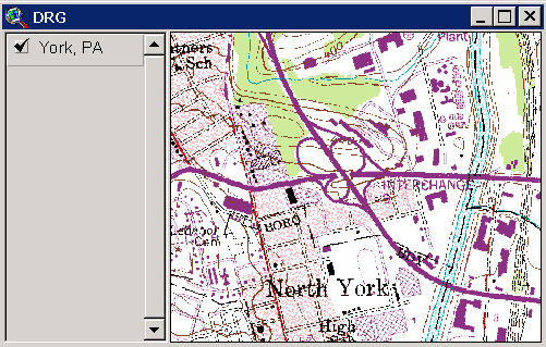
This is a Digitial Raster Graphic (DRG) of York Pennsylvania NE. A Digital Raster Graphic (DRG) is a raster image of a scanned USGS topographic or planimetric map that is georeferenced to a real-world coordinate system.
A DRG is useful as a source or background layer in a GIS as a means to perform quality assurance on other GIS layers, and as a source for digitizing and and revising vector data. DRGs can also be merged with other digital data, for example, DEMs or DOQs to produce a composite image.
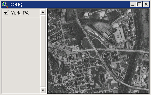
This is Digital Ortho Quarter Quaddrangle (DOQQ) of York Pennslyvania. Orthophotos combine the image characteristics of a photograph with the geometric qualities of a map. DOQQ's serve a variety of purposes, from interim maps to field references for earth science investigations and analysis. Like the DRG, the DOQQ is useful as a layer of a geographic information system and as a tool for digitizing and revising new and existing vector data.
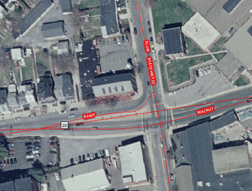
This raster is an orthoimage from the PAMAP program. An orthoimage is remotely sensed image data that has been positionally corrected for camera lens distortion, vertical displacement and variations in aircraft altitude and orientation. Orthoimagery combines the image characteristics of a photograph with the geometric qualities of a map. The PAMAP 2005 natural color orthoimages were produced at 1-foot pixel resolution. Each orthoimage provides imagery for a 10,000 x 10,000 ft. block on the ground. The projected coordinate system is Pennsylvania State Plane North with a NAD83 datum. There is no image overlap been adjacent files. The orthoimage filenames were derived from the northwest corner of each ortho tile using the first four digits of the northing and easting coordinates referenced to the Pennsylvania State Plane coordinate system, followed by the State designator "PA," and the State Plane zone designator "N." This dataset consists of 10000 x 10000 ft. uncompressed natural color (24-bit) GeoTIFF files at a pixel resolution of 1 foot. The imagery was captured at a negative scale of 1:19200 for the purpose of producing orthophotos
Access to the georeferenced Pennsylvania data will be provided to all PA state government agencies; regional, county and local governments within the Commonwealth of Pennsylvania including council of governments; K-12 public schools, state colleges and universities within Pennsylvania. The non-georeferenced JPEG imagery is accessible to anyone for viewing and downloading through PASDA.